Weather is the present state of the air all around you (in contrast to climate, which is the long-term state). Two key properties of weather are temperature and humidity.
Temperature
Temperature is measured in two ways: degrees Fahrenheit (°F) and degrees Celsius (°C). These differ in two ways. A degree C is about twice as large as a degree F. Also, the zero reference point—where water freezes—is 32 degrees higher for Fahrenheit than for Celsius.- Water freezes at 32°F and 0°C.
- Water boils at 212°F and 100°C.
For daily weather, you can get surprisingly close by remembering:
- °F is a larger number. Double Celsius temperature and add 30 to estimate Fahrenheit.
- °C is a smaller number. Subtract 30 from Fahrenheit and then cut it in half to estimate Celsius.
These shortcuts aren’t exact, but they’re usually within a couple of degrees—good enough for everyday use.
Humidity
Relative humidity is the amount of water vapor in the air, expressed as a percentage of the maximum that it can be when air is fully saturated at the current temperature. Warm air holds much more water than cold air. At 100 degrees F there can be up to 44 grams of water in a cubic meter of air. At 50 degrees, that maximum falls to only 9 grams and at 33 degrees—just above freezing—the max is 5 grams.Think of the air as a sponge: Temperature determines the size of the sponge—how much water it can hold—while relative humidity shows how wet it is, whether sopping or partially wrung out. For any given amount of water in the air, the temperature at which that water would cause 100% relative humidity is called the dew point. At any lower temperature, water will leave the air as condensation, forming clouds.
A dew point below 50 degrees F feels dry and comfortable. 50 to 60 degrees feels crisp and slightly humid. At 60 to 65 degrees the air feels sticky and muggy. Above 65 degrees it is oppressive and tropical. A high dew point means rain is likely, especially if the dew point is rising. Nighttime temperatures often drop precisely to the dew point on clear, calm nights. The relative humidity is then 100% causing morning dew, frost, or fog.
Air pressure
The main element of weather is wind caused by air moving from places of high pressure to low pressure. It moves in curved lines owing to rotation of the earth: the coriolis effect. This is why storm systems, such as hurricanes, rotate counterclockwise in the northern hemisphere. (See also Instruments>Barometer.)In high pressure places the colder and denser air is falling and absorbing moisture. These places have clearer skies, lighter or steadier wind, and more stable weather. In low pressure areas, the warmer and less dense air is rising and releasing moisture. These places have clouds, stronger or shifting winds often with rain, and unsettled weather. If you stand with your back to the wind, low pressure is on your left and high pressure is on your right (in the northern hemisphere). The boundary between two such places is called a front.
Clouds
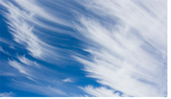
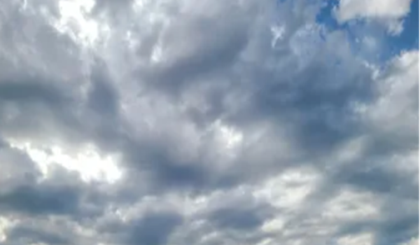
Clouds are among the best ways of forecasting the weather short term. The taller or more vertical a cloud is, the more energy it contains. The process of hot air rising and cold air sinking is called convection, and this is how cloud patterns evolve. In a large, stable weather system (ie, a front or rainy region) clouds will form even sheets or organized layers with a smooth gradient. In changing weather the unstable air will form a chaotic mix of clouds with different shapes, at different heights and moving in different directions.High thin clouds—especially cirrus or cirrostratus—are often the first sign of an approaching cold front or, sometimes, a warm front. Growing puffy clouds can mean daytime heating, instability, sea breezes, and possible showers. Dark towering clouds predict rough seas with potential squalls, thunderstorms, sharp gusts, perhaps lightning. Low gray overcast means steady rain or drizzle with reduced visibility.
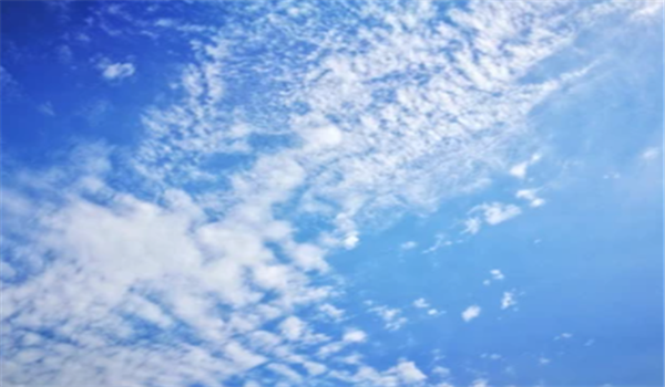
The high clouds include cirrus (wispy streaks or thin horsetails) that mean fair weather now but a change is coming, usually a cold front. If they thicken or multiply, expect the wind to shift and the weather to deteriorate. Also cirrostratus clouds (a white veil covering the sky and a halo around the sun) that mean a warm front is approaching.
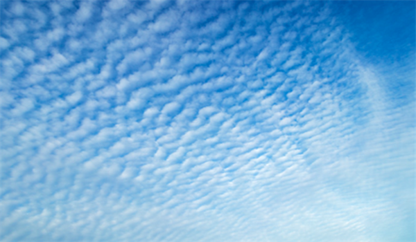
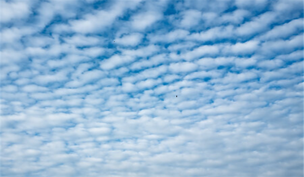
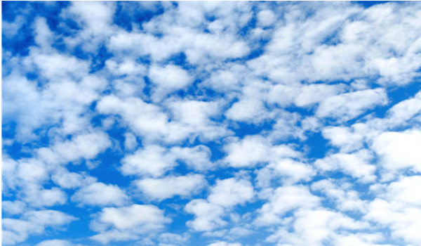
Middle clouds include altostratus (a gray film covers the sky and dims the sun), which signal heavier conditions with rain and rising wind. Also altocumulus (cotton ball clusters or wavelike patterns). If they are seen in the morning, afternoon thunderstorms are likely. If they grow taller, expect gusty, shifty winds.
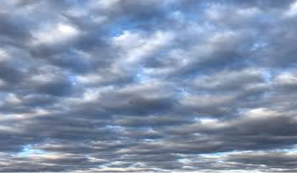
Low clouds signal a quick change bringing wind and rain. They include stratus (low, flat, gray overcast) that bring low visibility and light wind with fog and possible drizzle. Also stratocumulus (broken gray layer with gaps of blue showing) that signal moderate winds, often steady, and somewhat unsettled but generally stable conditions. Nimbostratus clouds form a thick, dark sky with steady rain and shifty wind as a front passes.
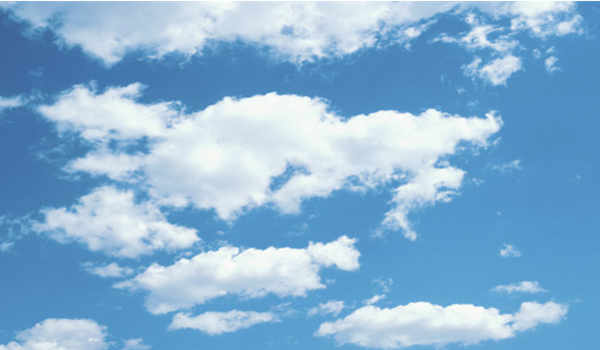
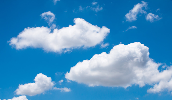
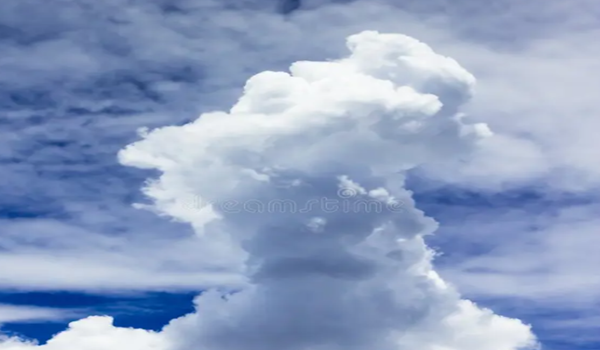
Vertical clouds are the most important to sailors. Cumulus clouds (puffy cotton balls) bring light to moderate breezes, often steady but with gusts under the clouds. Watch for them to grow taller into cumulonimbus clouds (tall towers with anvil tops) that bring sudden squalls, violent wind shifts, and sometimes lightning or hail.

If clouds are getting higher and thinner, a front is approaching and weather will get worse. If they are getting lower and thicker, the front has arrived bringing rain or storms. When cumulus clouds grow taller, afternoon thunderstorms or squalls are likely. When they are dark and uniform, expect a long period of rain with steady, shifting winds.
Standard Cloud Name Abbreviations
|
High clouds Ci = Cirrus Cs = Cirrostratus Cc = Cirrocumulus. |
Middle clouds As = Altostratus Ac = Altocumulus. |
|
Low clouds St = Stratus Sc = Stratocumulus Ns = Nimbostratus. |
Vertical development Cu = Cumulus TCu = Towering cumulus Cb = Cumulonimbus. |
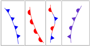
Cloud Shapes
|
Wispy or hair-like Cirrus family (Ci or Cs or Cc) Change coming (weather system nearby). |
Flat sheet or blanket Stratus family (St or Ns) Stable or steady precipitation. |
|
Puffy or cauliflower Cumulus family (Cu or Ac or Sc) Convection or developing weather. |
Tall tower or growing upward TCu becoming Cb Storm energy present. |
Thunderstorms
Taken together, wind, clouds, and barometer readings can predict thunderstorms, which are best viewed as a system. Light to moderate winds bring in warm moist air near the surface that rises, cools, and releases water vapor into cumulus clouds. A barometer reads low pressure (that's why warm air is rushing in) and is either steady or slowly rising.Strong updrafts of warm air make the clouds grow taller as energy is stored. Under the right wind shear conditions, rapid vertical growth builds towering cumulus clouds with sharp tops and flat bottoms.
When the clouds form into cumulonimbus—thunderstorm clouds—rain starts to fall, thunder begins, and downdrafts join the updrafts. This drags air downward, cooling it and causing gusty shifting winds at the surface.
As rain continues, downdrafts begin to dominate and updrafts collapse. Thunder stops. Rain becomes lighter as the clouds begin to break apart. The barometer rises as falling cool, dense air displaces inrushing warm air and the storm is ending.
Hurricanes
A hurricane is a tropical cyclone: a low-pressure rotating storm system with high winds. Seeded by dust from the Sahara, they form near the equator in the Atlantic and generally move eastward as the earth rotates beneath them. Hurricanes are ranked from 1 to 5 by their maximum sustained wind on the Saffir-Simpson scale. Categories 3 and higher are of the most immediate concern.During hurricane season—the six months from June 1 to November 30—on average 14 tropical storms form in the Atlantic, half of which become hurricanes. The season builds to a peak in September and then declines. El Niño (warm surface in the Pacific) suppresses hurricanes by increasing wind shear; however, this makes any storms that do form more severe. La Niña (cold Pacific) has the opposite effect.
A hurricane has an eye at the center where the weather is sunny and mild with no wind. All around the eye, a violent eyewall of intense wind funnels warm, moist air upward. Spiraling rainbands of clouds and thunderstorms release energy as water in the rising air cools and condenses. This energy drives rising winds and a continuous supply of storm clouds until landfall. Able to grow to more than 1,000 miles in diameter, tropical cyclones can unleash not just high winds, the main concern of sailors, but also several feet of rain and storm surge, the major risk ashore.
Hurricane conditions are worst on the dirty side—the right front quadrant—where the hurricane’s motion and its rotation combine to move air in the same direction. Upon making landfall, these winds pull water from the ocean onto land, causing storm surge. Extreme wind shear—the differing speed of wind at various heights—can cause tornadoes.
There is usually ample notice that a hurricane is coming, often several days in advance. The best place for a sailboat to be then is hauled and blocked ashore. The next best place is at sea, using storm tactics under little or no canvas and well off of any lee shore. The worst place to be is at dock where lines should be doubled and storm surge allowed for. In any case, remove and stow below all sails (except storm sails if at sea), all canvas, and anything carried on deck, such as fenders. Lash the dinghy securely upside down on the foredeck.
Effect of
wind shear
If wind shear—change in wind speed or direction at various heights—is weak, the updrafts of warm air go straight up and the downdrafts of cold air fall straight down, counteracting the updrafts. The storm then collapses on itself in 20 to 60 minutes.With moderate wind shear, downdrafts are pushed away from updrafts and the storm both grows stronger and propagates. There will be repeated bursts of heavy rain and thunder with strong wind gusts and possible hail.
Strong wind shear blows the tops of the towering clouds away from the updrafts. The downdrafts on the outflow side of the cloud column then fall alongside the updrafts on the inflow side and do not neutralize them. The storm is then self-sustaining and might last for hours.